Safeguarding Infrastructure, With Insight and Precision
Expert geohazard analysis, remote monitoring, and risk modeling.
What We Do
Remote Monitoring
We deploy satellite imagery, field data, and intelligent reporting tools to detect and track geomorphological changes in real time
Use Cases: Landslide detection, river migration, slope instability, erosion monitoring.
Post-Disaster Risk Assessment
Our team delivers clear assessments of residual risk and helps prioritize recovery efforts.
Use Cases: Rapid inventories of landslides, risk mapping, hazard prioritization.
Custom Geohazard Inventories
Tailored inventories of geomorphological units, mass movements, and fluvial processes using high-resolution imagery and GIS tools.
Use Cases: Site-specific hazard classification, sediment transport mapping, pre-development assessments.
Infrastructure Risk Analysis
Geotechnical and hydrotechnical threat assessments to critical infrastructure such as pipelines, dams, reservoirs, and hydroelectric plants.
Use Cases: Mass movement inventories, machine-learning-based risk mapping, risk mitigation planning.
Predictive Modeling & Simulation
Future hazard scenarios simulations using advanced hydrological and geomorphological modeling to support long-term planning and investment decisions.
Use Cases: Debris flow simulations, rainfall-runoff models, sediment source analysis.
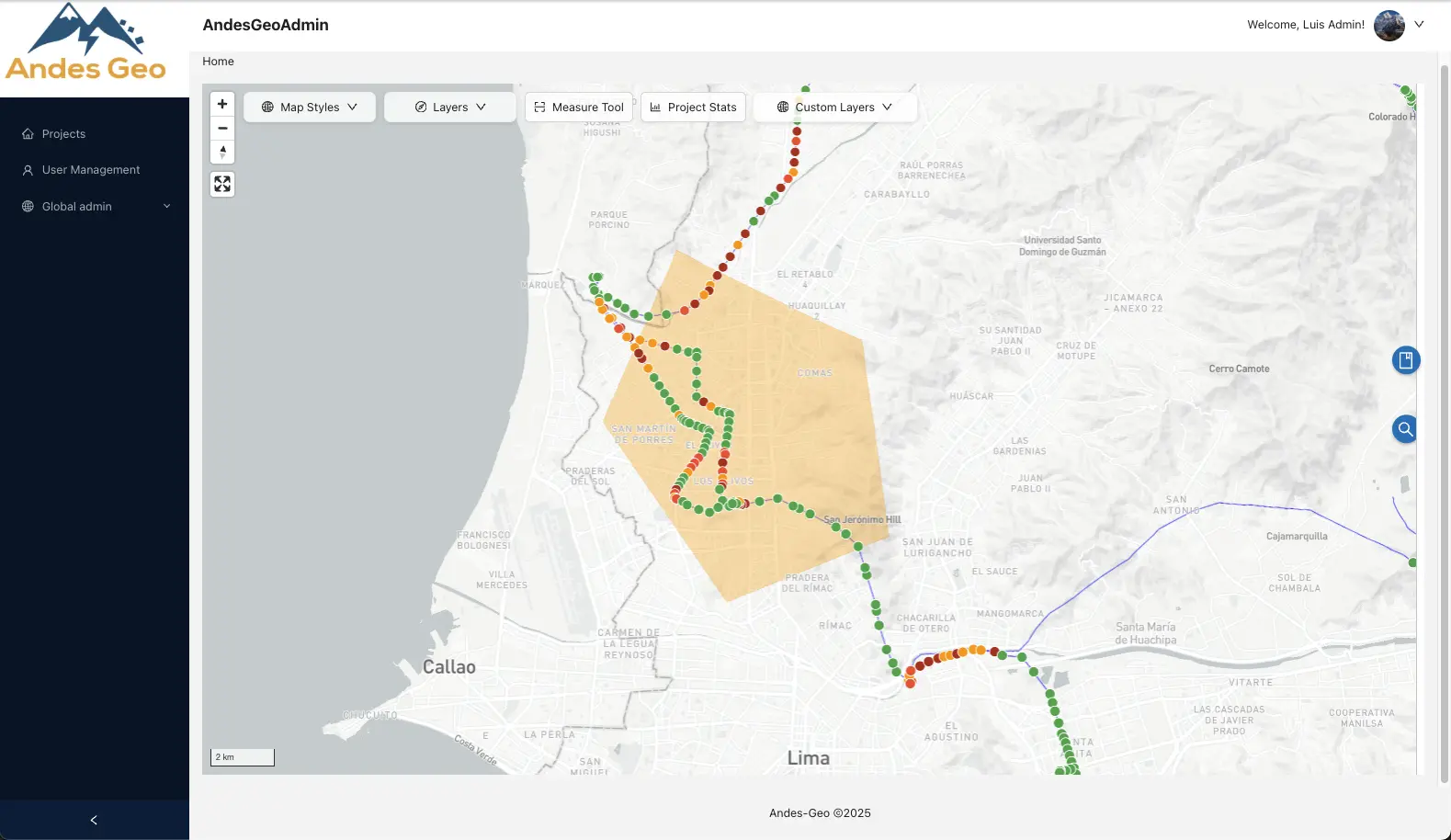
INTRODUCING GeoHAS
Our AI-powered, interactive dashboard. Designed to help you understand, identify, and manage risks to critical infrastructure
Built for decision-makers facing a changing climate, GeoHAS brings together powerful data, advanced visualization, and real-time alerts, all in one intuitive platform.
Everything You Need to Identify, Assess, and Manage Risk

Powerful Features Built for Risk Professionals
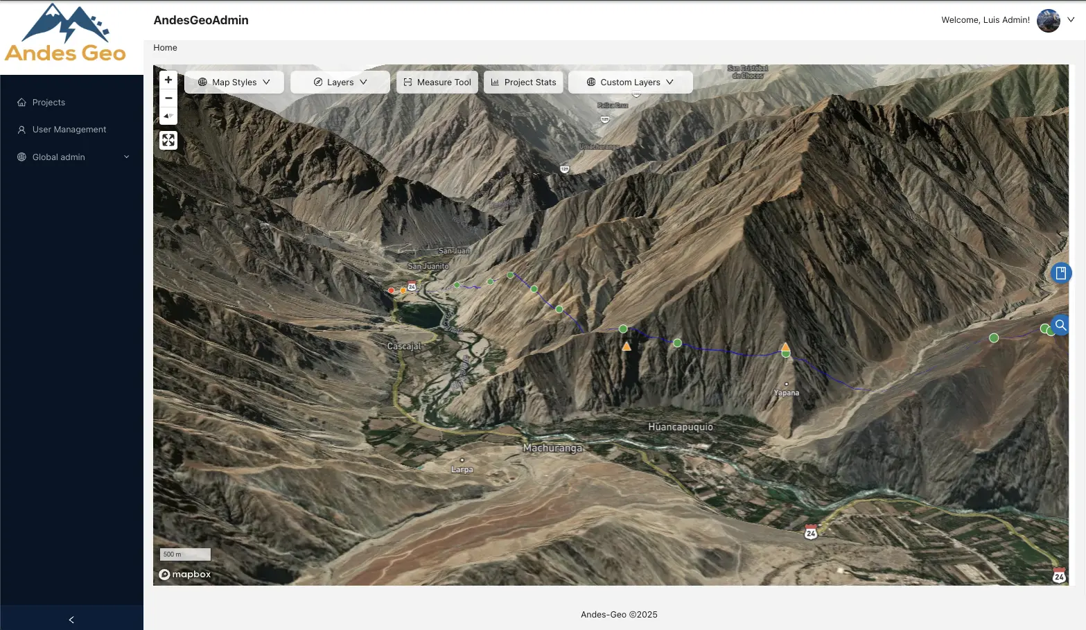
3D Geospatial Visualization
View your assets in context with terrain-aware visual tools and digital elevation models.
Interactive Dashboard
Navigate multiple data layers with a clear, user-friendly interface.
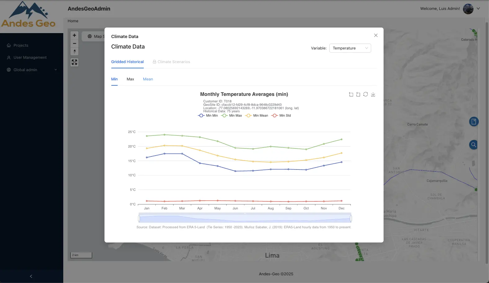
Climate Risk Scoring
A+
Assess vulnerability at the asset or regional level using our built-in climate risk scoring engine.
Import/Export Capabilities
Easily bring in your own geodata or export reports and visualizations to share with stakeholders.
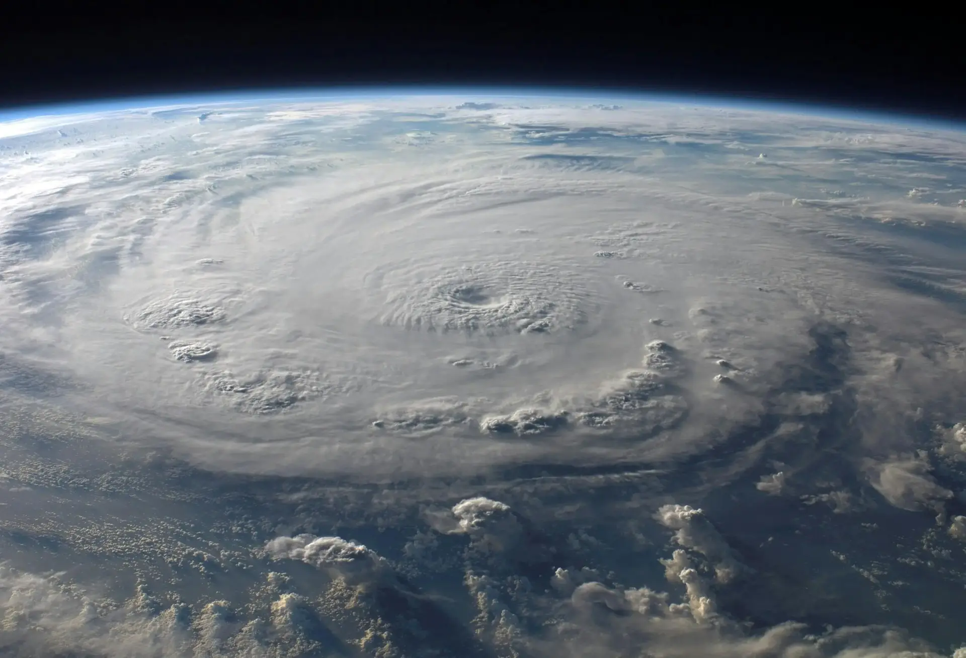
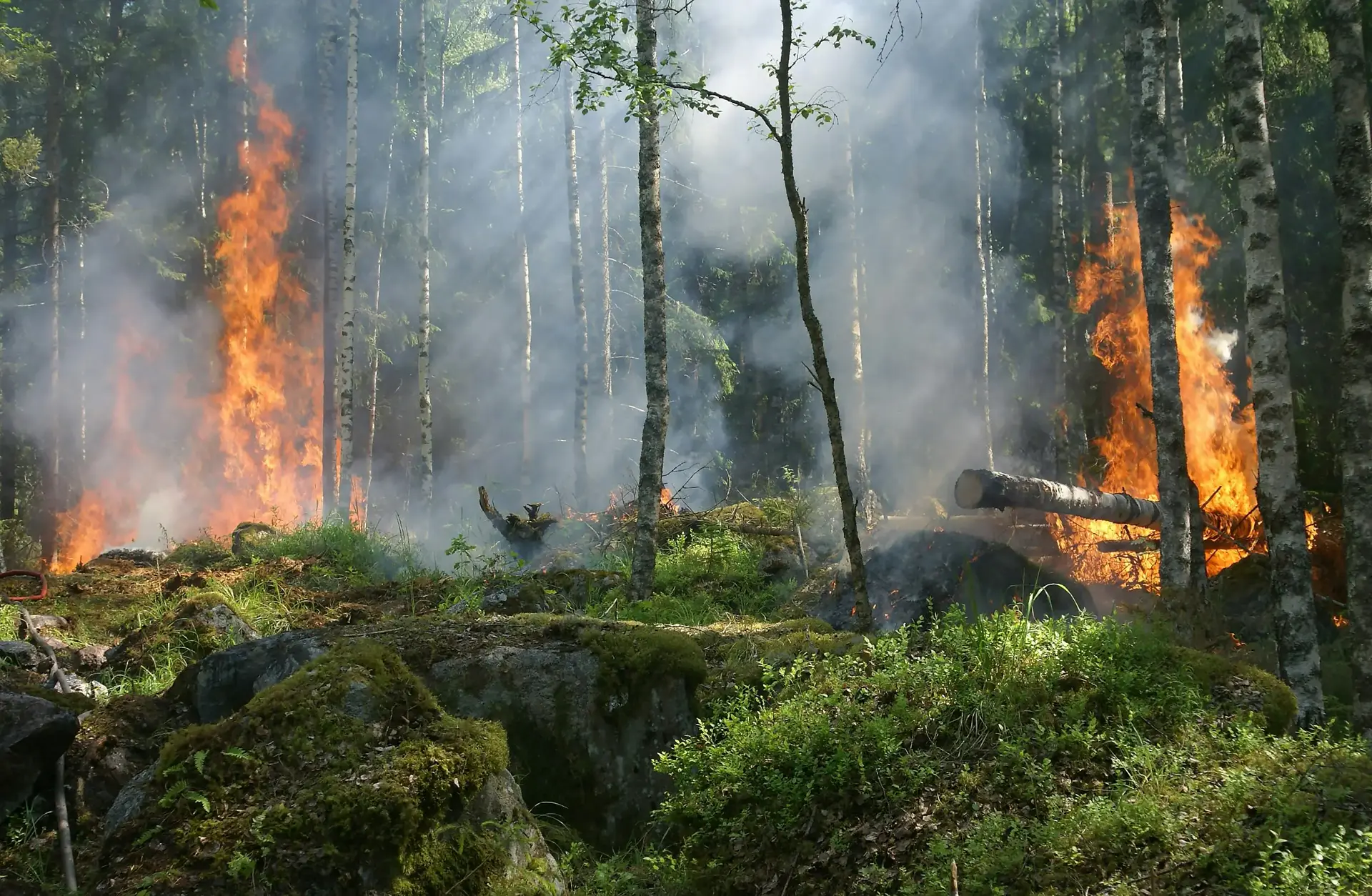
Early Warning System
Real-time alerts for hazards like landslides, fires, and extreme weather—so you can act fast and stay protected.
Multiple Data Layers
Toggle terrain, infrastructure, weather, and risk zones to visualize exposure and make informed decisions.


3D Geospatial Visualization
View your assets in context with terrain-aware visual tools and digital elevation models.
Interactive Dashboard
Navigate multiple data layers with a clear, user-friendly interface.
Climate Risk Scoring
A+
Assess vulnerability at the asset or regional level using our built-in climate risk scoring engine.
Import/Export Capabilities
Easily bring in your own geodata or export reports and visualizations to share with stakeholders.
Early Warning System
Real-time alerts for hazards like landslides, fires, and extreme weather—so you can act fast and stay protected.
Multiple Data Layers
Toggle terrain, infrastructure, weather, and risk zones to visualize exposure and make informed decisions.
Built for:
- Government agencies managing public infrastructure
- Insurers and reinsurers modeling climate risk
- Energy and utility companies with assets in remote or unstable terrain
- Investors and asset managers conducting due diligence
Our Mission
At Andes Geo, we are passionate about empowering organizations to make informed decisions for a thriving, climate-resilient world.
We are dedicated to providing geospatial digital solutions and consulting services that create a positive impact
Our Clients
Trusted by leaders in energy, infrastructure, and public safety
Our clients partner with us to make informed, data-driven decisions about geohazard risk, ensuring long-term resilience and operational integrity.