
Leveraging Public Data and GIS to Screen for Potential Landslides.
Mass movements or landslides are widespread geohazards in the Alberta landscape. There are multiple types and mechanisms of landslides depending on the different combinations of geotechnical and environmental controls (e.g., slope, soil types, hydrology, and bedrock geology). In November 2019, the Alberta Energy Regulator (AER) published a bulletin indicating that pipeline integrity management programs must consider slope movements (AER, 2019). The publication came as the AER observed a small increase in pipeline failures related to geotechnical issues.
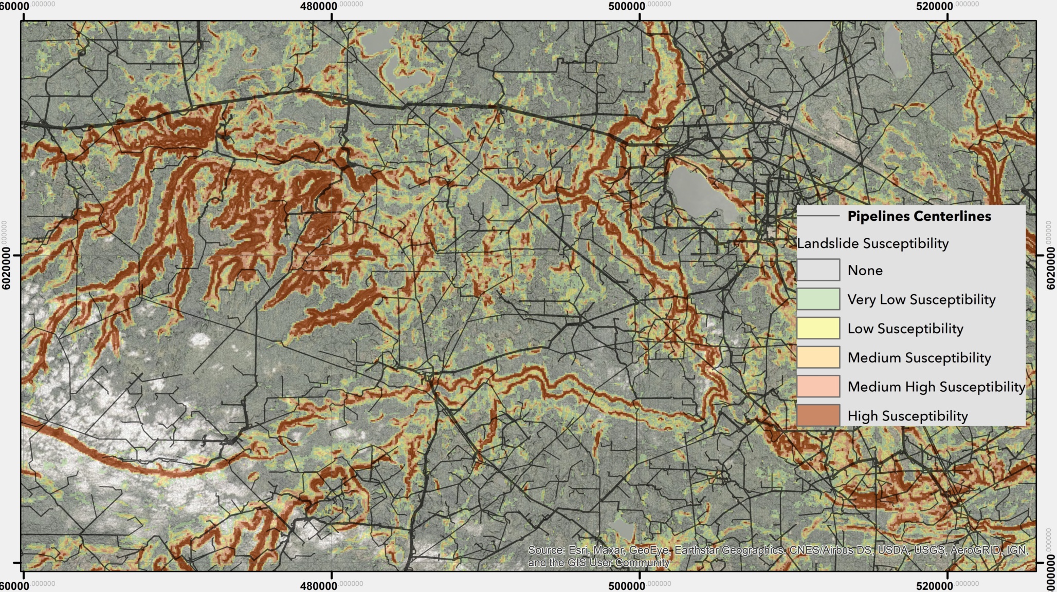
As some pipeline operators might be starting to improve or develop their geohazards inventory, I wanted to share this small piece of information for their consideration. Screening for landslide prone areas at a regional scale does not need to be an overwhelming or costly exercise. The power of the geoprocessing tools, integrated with most geographic information software (GIS), allows using multiple methods for landslide hazard and susceptibility. The results are suitable and defendable at the screening scale. These methods have been applied since the 1970s (Soeters and Van Westen 1996). They have improved in the last decade by using machine and deep learning techniques based on GIS. That said, a high-level overview study of your pipeline system should run smoothly, provided you have the data, do your research, and have the right team in place. The real work comes after the screening stage when landslide activity assessment and landslide frequency is required to understand risk.
Furthermore, the AER developed a Relative Landslide Susceptibility Model of the Alberta Plains and Shield Regions (Pawley et al. 2016). Although this product was conducted at a coarse scale (1:1 000 000), it provides valuable information to start screening your geohazard sites. The best part is publicly available data. You can access these data are through the AER website.
I encourage people to start rethinking the way how we do business. Rather than reinventing the wheel, collaborate with your clients and other organizations to advance the existing knowledge. Share your data with the regulatory parties to refine products like the regional landslide susceptibility model. After all, Alberta’s pipeline integrity concerns all of us who live in the province.
References and Resource:
Pawley, S.M., Hartman, G.M.D. and Chao, D.K. (2016): Relative landslide susceptibility model of the Alberta Plains and shield regions; Alberta Energy Regulator, AER/AGS Map 605, scale 1:1 000 000
Soeters, R., & Van Westen, C. J. (1996). Slope instability recognition, analysis and zonation. Landslides: investigation and mitigation, 247, 129-177.